Every route below is calculated from this exact station.
23 destinations for Sat, 29 Aug 2026 – Sun, 30 Aug 2026
-
Jogyesa Temple조계사
Jongno-gu, Seoul
66 ScoreThe head temple of the Jogye Order, in the middle of downtown Seoul — the easiest working temple to reach.
- Estimated travel time
- Approx. 23 min by public transit Full route ↓
- Walking difficulty
- Moderate 10 min from 종각
- Event
- 1 event on this date
- Data freshness
- 2026-08-17 Curated estimate
Route verified from Seoul Station, checked 2026-08-26
Get directions in Google Maps Directions from Seoul StationTimes above use Kakao transit data. The first button uses your current location in Google Maps; live routes may differ.
Temple- "Gugak Performance Jinyeon (국악공연 진연)" is running on your date
- Well inside your time budget — about 23 min each way
Gugak Performance Jinyeon (국악공연 진연) — Thu, 1 Jan 2026 – Thu, 31 Dec 2026
Full route (23 min, 0 transfers, ₩1,550)
- Start at Seoul Station
- Take Subway 1호선 from 서울역 to 종각 (5 min)
- Walk from the last stop to the destination (10 min)
Checked against Kakao Maps's public-transit search on 2026-08-26. Service frequency isn't reported by this data, so a route shown here could still run infrequently — this reflects that a path exists, not how often it runs.
How this score was calculated
Interest match 26.0 / 40 Travel fit 20.5 / 25 Walking fit 10.5 / 15 Event bonus 9.0 / 15 Season fit 0.0 / 5 Total 66 / 100 -
Anyang Art Park안양예술공원
Anyang, Gyeonggi-do
65 ScoreA wooded valley with outdoor architectural installations along a stream, free to enter.
- Estimated travel time
- Approx. 46 min by public transit Full route ↓
- Walking difficulty
- Easy 3 min from 안양예술공원종점.갈멜산기도원입구
- Event
- 1 event on this date
- Data freshness
- 2026-08-17 Curated estimate
Route verified from Seoul Station, checked 2026-08-26
Get directions in Google Maps Directions from Seoul StationTimes above use Kakao transit data. The first button uses your current location in Google Maps; live routes may differ.
NatureCafe- "APAP Artwork Tour (APAP 작품투어 (안양공공예술프로젝트))" is running on your date
- Well inside your time budget — about 46 min each way
- Almost no walking — 3 min from Anyang Art Park bus stop
APAP Artwork Tour (APAP 작품투어 (안양공공예술프로젝트)) — Tue, 10 Mar 2026 – Mon, 30 Nov 2026
Full route (46 min, 1 transfer, ₩2,050)
- Start at Seoul Station
- Take Subway 1호선 from 서울역 to 안양 (22 min)
- Walk to the next connection (3 min)
- Take Bus 2 from 안양역 to 안양예술공원종점.갈멜산기도원입구 (11 min)
- Walk from the last stop to the destination (3 min)
Checked against Kakao Maps's public-transit search on 2026-08-26. Service frequency isn't reported by this data, so a route shown here could still run infrequently — this reflects that a path exists, not how often it runs.
How this score was calculated
Interest match 26.0 / 40 Travel fit 16.1 / 25 Walking fit 13.7 / 15 Event bonus 9.0 / 15 Season fit 0.0 / 5 Total 65 / 100 -
Namdaemun Market남대문시장
Jung-gu, Seoul
62 ScoreKorea's largest traditional market, with a dense street-food alley and wholesale arcades.
- Estimated travel time
- Approx. 10 min by public transit Full route ↓
- Walking difficulty
- Easy 5 min from 회현(남대문시장)
- Event
- No event on this date
- Data freshness
- 2026-08-17 Curated estimate
Route verified from Seoul Station, checked 2026-08-26
Get directions in Google Maps Directions from Seoul StationTimes above use Kakao transit data. The first button uses your current location in Google Maps; live routes may differ.
Traditional MarketFood- Well inside your time budget — about 10 min each way
- Almost no walking — 5 min from Hoehyeon Stn
Full route (10 min, 0 transfers, ₩1,550)
- Start at Seoul Station
- Take Subway 4호선 from 서울역 to 회현(남대문시장) (2 min)
- Walk from the last stop to the destination (5 min)
Checked against Kakao Maps's public-transit search on 2026-08-26. Service frequency isn't reported by this data, so a route shown here could still run infrequently — this reflects that a path exists, not how often it runs.
How this score was calculated
Interest match 26.0 / 40 Travel fit 23.1 / 25 Walking fit 12.8 / 15 Event bonus 0.0 / 15 Season fit 0.0 / 5 Total 62 / 100 -
Heyri Art Valley헤이리 예술마을
Paju, Gyeonggi-do
61 ScoreA purpose-built village of artist studios, small galleries and architect-designed cafes near the DMZ side of Paju.
- Estimated travel time
- Approx. 58 min by public transit Full route ↓
- Walking difficulty
- Easy 7 min from 경모공원앞.헤이리6번게이트
- Event
- 1 event on this date
- Data freshness
- 2026-08-17 Curated estimate
Route verified from Seoul Station, checked 2026-08-26
Get directions in Google Maps Directions from Seoul StationTimes above use Kakao transit data. The first button uses your current location in Google Maps; live routes may differ.
Cafe- "Ssokssokdeul-i Festival (국립극장 쏙쏙들이페스티벌)" is running on your date
- Almost no walking — 7 min from Heyri Art Valley bus stop
Ssokssokdeul-i Festival (국립극장 쏙쏙들이페스티벌) — Sat, 14 Mar 2026 – Sat, 26 Dec 2026
Full route (58 min, 2 transfers, ₩6,000)
- Start at Seoul Station
- Take Subway GTX-A from 서울역 to 운정중앙 (22 min)
- Walk to the next connection (2 min)
- Take Bus 089 from 운정중앙역(지하) to 책향기마을14단지 (5 min)
- Take Bus 2200-1 from 책향기마을14단지 to 경모공원앞.헤이리6번게이트 (18 min)
- Walk from the last stop to the destination (7 min)
Checked against Kakao Maps's public-transit search on 2026-08-26. Service frequency isn't reported by this data, so a route shown here could still run infrequently — this reflects that a path exists, not how often it runs.
How this score was calculated
Interest match 26.0 / 40 Travel fit 13.7 / 25 Walking fit 11.9 / 15 Event bonus 9.0 / 15 Season fit 0.0 / 5 Total 61 / 100 -
Namsan Seoul Tower남산서울타워
Jung-gu, Seoul
58 ScoreThe classic 360° view over Seoul from the top of Namsan, reachable on foot, by bus, or by cable car.
- Estimated travel time
- Approx. 29 min by public transit Full route ↓
- Walking difficulty
- Easy 6 min from 남산서울타워
- Event
- No event on this date
- Data freshness
- 2026-08-17 Curated estimate
Route verified from Seoul Station, checked 2026-08-26
Get directions in Google Maps Directions from Seoul StationTimes above use Kakao transit data. The first button uses your current location in Google Maps; live routes may differ.
Night ViewNature- Well inside your time budget — about 29 min each way
- Almost no walking — 6 min from Namsan cable car upper station
Full route (29 min, 1 transfer, ₩1,550)
- Start at Seoul Station
- Take Subway 4호선 from 서울역 to 충무로 (5 min)
- Walk to the next connection (3 min)
- Take Bus 01B from 충무로역2번출구 to 남산서울타워 (14 min)
- Walk from the last stop to the destination (6 min)
Checked against Kakao Maps's public-transit search on 2026-08-26. Service frequency isn't reported by this data, so a route shown here could still run infrequently — this reflects that a path exists, not how often it runs.
How this score was calculated
Interest match 26.0 / 40 Travel fit 19.4 / 25 Walking fit 12.3 / 15 Event bonus 0.0 / 15 Season fit 0.0 / 5 Total 58 / 100 -
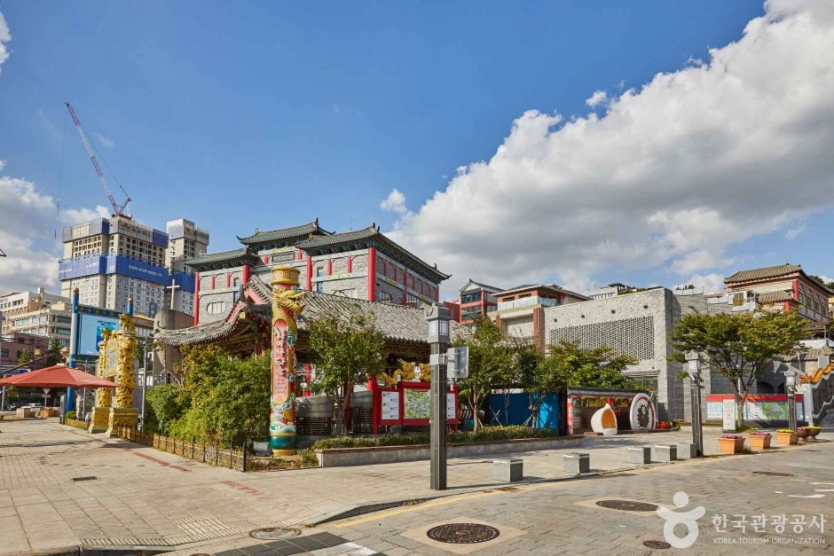
Incheon Chinatown & Open Port Area인천 차이나타운
Jung-gu, Incheon
49 ScoreKorea's only official Chinatown, next to the colonial-era open port district — the birthplace of jajangmyeon.
- Estimated travel time
- Approx. 1 hr 21 min by public transit Full route ↓
- Walking difficulty
- Easy 4 min from 인천
- Event
- No event on this date
- Data freshness
- 2026-08-17 Curated estimate
Route verified from Seoul Station, checked 2026-08-26
Get directions in Google Maps Directions from Seoul StationTimes above use Kakao transit data. The first button uses your current location in Google Maps; live routes may differ.
FoodCafeTraditional Market- Almost no walking — 4 min from Incheon Stn
Full route (81 min, 0 transfers, ₩2,150)
- Start at Seoul Station
- Take Subway 1호선 from 서울역 to 인천 (69 min)
- Walk from the last stop to the destination (4 min)
Checked against Kakao Maps's public-transit search on 2026-08-26. Service frequency isn't reported by this data, so a route shown here could still run infrequently — this reflects that a path exists, not how often it runs.
How this score was calculated
Interest match 26.0 / 40 Travel fit 9.3 / 25 Walking fit 13.2 / 15 Event bonus 0.0 / 15 Season fit 0.0 / 5 Total 49 / 100 -
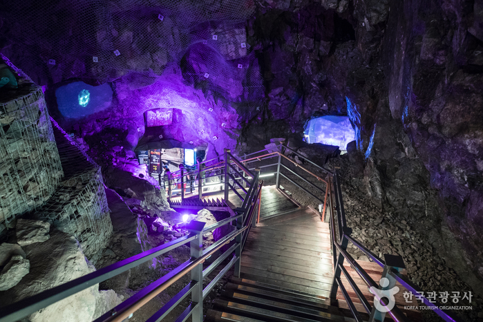
Gwangmyeong Cave광명동굴
Gwangmyeong, Gyeonggi-do
55 ScoreA disused gold mine converted into a walk-through cave attraction — cold inside year round, so a good summer option.
- Estimated travel time
- Approx. 1 hr 1 min by public transit Full route ↓
- Walking difficulty
- Moderate 9 min from 뒷골
- Event
- No event on this date
- Data freshness
- 2026-08-17 Curated estimate
Route verified from Seoul Station, checked 2026-08-26
Get directions in Google Maps Directions from Seoul StationTimes above use Kakao transit data. The first button uses your current location in Google Maps; live routes may differ.
Nature- Good time of year to visit
Full route (61 min, 2 transfers, ₩3,200)
- Start at Seoul Station
- Take Subway 4호선 from 서울역 to 사당 (17 min)
- Walk to the next connection (6 min)
- Take Bus 8507 from 사당역4번출구 to KTX광명역3번출구 (20 min)
- Walk to the next connection (4 min)
- Take Bus 88 from KTX광명역7번출구 to 뒷골 (6 min)
- Walk from the last stop to the destination (9 min)
Checked against Kakao Maps's public-transit search on 2026-08-26. Service frequency isn't reported by this data, so a route shown here could still run infrequently — this reflects that a path exists, not how often it runs.
How this score was calculated
Interest match 26.0 / 40 Travel fit 13.1 / 25 Walking fit 11.0 / 15 Event bonus 0.0 / 15 Season fit 5.0 / 5 Total 55 / 100 -

Ikseon-dong Hanok Village익선동 한옥마을
Jongno-gu, Seoul
58 ScoreA grid of narrow alleys where 1920s hanok houses have been converted into cafes and small restaurants.
- Estimated travel time
- Approx. 24 min by public transit Full route ↓
- Walking difficulty
- Moderate 8 min from 종로3가
- Event
- No event on this date
- Data freshness
- 2026-08-17 Curated estimate
Route verified from Seoul Station, checked 2026-08-26
Get directions in Google Maps Directions from Seoul StationTimes above use Kakao transit data. The first button uses your current location in Google Maps; live routes may differ.
CafeFood- Well inside your time budget — about 24 min each way
Full route (24 min, 0 transfers, ₩1,550)
- Start at Seoul Station
- Take Subway 1호선 from 서울역 to 종로3가 (7 min)
- Walk from the last stop to the destination (8 min)
Checked against Kakao Maps's public-transit search on 2026-08-26. Service frequency isn't reported by this data, so a route shown here could still run infrequently — this reflects that a path exists, not how often it runs.
How this score was calculated
Interest match 26.0 / 40 Travel fit 20.3 / 25 Walking fit 11.4 / 15 Event bonus 0.0 / 15 Season fit 0.0 / 5 Total 58 / 100 -
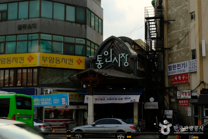
Tongin Market통인시장
Jongno-gu, Seoul
58 ScoreA small neighbourhood market in Seochon known for its brass-coin lunchbox system.
- Estimated travel time
- Approx. 28 min by public transit Full route ↓
- Walking difficulty
- Easy 5 min from 통인시장종로구보건소
- Event
- No event on this date
- Data freshness
- 2026-08-17 Curated estimate
Route verified from Seoul Station, checked 2026-08-26
Get directions in Google Maps Directions from Seoul StationTimes above use Kakao transit data. The first button uses your current location in Google Maps; live routes may differ.
Traditional MarketFood- Well inside your time budget — about 28 min each way
- Almost no walking — 5 min from Gyeongbokgung Stn
Full route (28 min, 0 transfers, ₩1,500)
- Start at Seoul Station
- Take Bus 1711 from 갈월동 to 통인시장종로구보건소 (19 min)
- Walk from the last stop to the destination (5 min)
Checked against Kakao Maps's public-transit search on 2026-08-26. Service frequency isn't reported by this data, so a route shown here could still run infrequently — this reflects that a path exists, not how often it runs.
How this score was calculated
Interest match 26.0 / 40 Travel fit 19.6 / 25 Walking fit 12.8 / 15 Event bonus 0.0 / 15 Season fit 0.0 / 5 Total 58 / 100 -
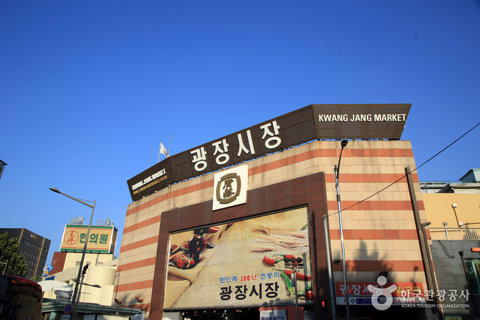
Gwangjang Market광장시장
Jongno-gu, Seoul
57 ScoreA covered market best known for its sit-down food alley — bindaetteok, mayak gimbap and raw beef tartare.
- Estimated travel time
- Approx. 27 min by public transit Full route ↓
- Walking difficulty
- Moderate 9 min from 종로5가
- Event
- No event on this date
- Data freshness
- 2026-08-17 Curated estimate
Route verified from Seoul Station, checked 2026-08-26
Get directions in Google Maps Directions from Seoul StationTimes above use Kakao transit data. The first button uses your current location in Google Maps; live routes may differ.
Traditional MarketFood- Well inside your time budget — about 27 min each way
Full route (27 min, 0 transfers, ₩1,550)
- Start at Seoul Station
- Take Subway 1호선 from 서울역 to 종로5가 (9 min)
- Walk from the last stop to the destination (9 min)
Checked against Kakao Maps's public-transit search on 2026-08-26. Service frequency isn't reported by this data, so a route shown here could still run infrequently — this reflects that a path exists, not how often it runs.
How this score was calculated
Interest match 26.0 / 40 Travel fit 19.8 / 25 Walking fit 11.0 / 15 Event bonus 0.0 / 15 Season fit 0.0 / 5 Total 57 / 100 -
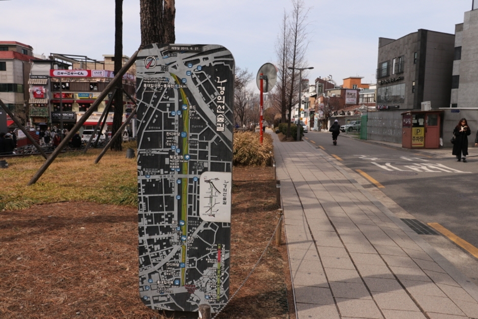
Yeonnam-dong & Gyeongui Line Forest Park연남동 경의선숲길
Mapo-gu, Seoul
58 ScoreA linear park built on a decommissioned railway, lined with cafes, bakeries and small restaurants.
- Estimated travel time
- Approx. 27 min by public transit Full route ↓
- Walking difficulty
- Easy 7 min from 홍대입구
- Event
- No event on this date
- Data freshness
- 2026-08-17 Curated estimate
Route verified from Seoul Station, checked 2026-08-26
Get directions in Google Maps Directions from Seoul StationTimes above use Kakao transit data. The first button uses your current location in Google Maps; live routes may differ.
CafeFoodNature- Well inside your time budget — about 27 min each way
- Almost no walking — 7 min from Hongik Univ. Stn
Full route (27 min, 0 transfers, ₩1,550)
- Start at Seoul Station
- Take Subway 공항철도 from 서울역 to 홍대입구 (8 min)
- Walk from the last stop to the destination (7 min)
Checked against Kakao Maps's public-transit search on 2026-08-26. Service frequency isn't reported by this data, so a route shown here could still run infrequently — this reflects that a path exists, not how often it runs.
How this score was calculated
Interest match 26.0 / 40 Travel fit 19.8 / 25 Walking fit 11.9 / 15 Event bonus 0.0 / 15 Season fit 0.0 / 5 Total 58 / 100 -

Seoul Forest서울숲
Seongdong-gu, Seoul
57 ScoreA large riverside park with a deer enclosure and a wooded walking loop, ringed by independent cafes.
- Estimated travel time
- Approx. 33 min by public transit Full route ↓
- Walking difficulty
- Easy 5 min from 뚝섬서울숲
- Event
- No event on this date
- Data freshness
- 2026-08-17 Curated estimate
Route verified from Seoul Station, checked 2026-08-26
Get directions in Google Maps Directions from Seoul StationTimes above use Kakao transit data. The first button uses your current location in Google Maps; live routes may differ.
NatureCafe- Well inside your time budget — about 33 min each way
- Almost no walking — 5 min from Seoul Forest Stn
Full route (33 min, 2 transfers, ₩1,550)
- Start at Seoul Station
- Take Subway 4호선 from 서울역 to 충무로 (5 min)
- Walk to the next connection (2 min)
- Take Subway 3호선 from 충무로 to 옥수 (7 min)
- Walk to the next connection (3 min)
- Take Bus 성동13 from 옥수역5.6번출구.한강버스선착장 to 뚝섬서울숲 (11 min)
- Walk from the last stop to the destination (5 min)
Checked against Kakao Maps's public-transit search on 2026-08-26. Service frequency isn't reported by this data, so a route shown here could still run infrequently — this reflects that a path exists, not how often it runs.
How this score was calculated
Interest match 26.0 / 40 Travel fit 18.6 / 25 Walking fit 12.8 / 15 Event bonus 0.0 / 15 Season fit 0.0 / 5 Total 57 / 100 -
Bongeunsa Temple봉은사
Gangnam-gu, Seoul
54 ScoreA 1,200-year-old temple directly opposite the COEX complex, floodlit against the Gangnam skyline after dark.
- Estimated travel time
- Approx. 42 min by public transit Full route ↓
- Walking difficulty
- Moderate 8 min from 봉은사
- Event
- No event on this date
- Data freshness
- 2026-08-17 Curated estimate
Route verified from Seoul Station, checked 2026-08-26
Get directions in Google Maps Directions from Seoul StationTimes above use Kakao transit data. The first button uses your current location in Google Maps; live routes may differ.
TempleNight View- Well inside your time budget — about 42 min each way
Full route (42 min, 1 transfer, ₩1,650)
- Start at Seoul Station
- Take Subway 4호선 from 서울역 to 동작(현충원) (12 min)
- Walk to the next connection (7 min)
- Take Subway 9호선 from 동작(현충원) to 봉은사 (13 min)
- Walk from the last stop to the destination (8 min)
Checked against Kakao Maps's public-transit search on 2026-08-26. Service frequency isn't reported by this data, so a route shown here could still run infrequently — this reflects that a path exists, not how often it runs.
How this score was calculated
Interest match 26.0 / 40 Travel fit 16.8 / 25 Walking fit 11.4 / 15 Event bonus 0.0 / 15 Season fit 0.0 / 5 Total 54 / 100 -
Oido오이도
Siheung, Gyeonggi-do
55 ScoreA working tidal-flat harbour with a red lighthouse landmark and a row of clam and seafood restaurants.
- Estimated travel time
- Approx. 1 hr 17 min by public transit Full route ↓
- Walking difficulty
- Easy 2 min from 오이도종합어시장
- Event
- No event on this date
- Data freshness
- 2026-08-17 Curated estimate
Route verified from Seoul Station, checked 2026-08-26
Get directions in Google Maps Directions from Seoul StationTimes above use Kakao transit data. The first button uses your current location in Google Maps; live routes may differ.
SeaFoodNight View- Almost no walking — 2 min from Oido seafront bus stop
- Good time of year to visit
Full route (77 min, 2 transfers, ₩4,250)
- Start at Seoul Station
- Take Subway 4호선 from 서울역 to 사당 (17 min)
- Walk to the next connection (6 min)
- Take Bus P9541(퇴근) from 사당역4번출구 to 한라비발디1차 (39 min)
- Take Bus 63 from 한라비발디1차 to 오이도종합어시장 (12 min)
- Walk from the last stop to the destination (2 min)
Checked against Kakao Maps's public-transit search on 2026-08-26. Service frequency isn't reported by this data, so a route shown here could still run infrequently — this reflects that a path exists, not how often it runs.
How this score was calculated
Interest match 26.0 / 40 Travel fit 10.0 / 25 Walking fit 14.1 / 15 Event bonus 0.0 / 15 Season fit 5.0 / 5 Total 55 / 100 -
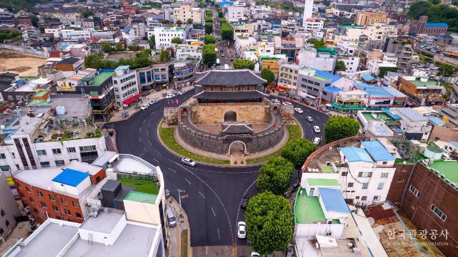
Suwon Hwaseong Fortress수원 화성
Suwon, Gyeonggi-do
50 ScoreA UNESCO-listed 18th-century fortress wall you can walk end to end, lit up at night and used for seasonal festivals.
- Estimated travel time
- Approx. 1 hr 11 min by public transit Full route ↓
- Walking difficulty
- Easy 4 min from 수원전통문화관.장안동
- Event
- No event on this date
- Data freshness
- 2026-08-17 Curated estimate
Route verified from Seoul Station, checked 2026-08-26
Get directions in Google Maps Directions from Seoul StationTimes above use Kakao transit data. The first button uses your current location in Google Maps; live routes may differ.
NatureNight ViewFoodFestival- Almost no walking — 4 min from Hwaseong Haenggung bus stop
Full route (71 min, 1 transfer, ₩3,400)
- Start at Seoul Station
- Take Subway 4호선 from 서울역 to 선바위 (22 min)
- Walk to the next connection (5 min)
- Take Bus 3000 from 선바위역2번출구(광역) to 수원전통문화관.장안동 (39 min)
- Walk from the last stop to the destination (4 min)
Checked against Kakao Maps's public-transit search on 2026-08-26. Service frequency isn't reported by this data, so a route shown here could still run infrequently — this reflects that a path exists, not how often it runs.
How this score was calculated
Interest match 26.0 / 40 Travel fit 11.2 / 25 Walking fit 13.2 / 15 Event bonus 0.0 / 15 Season fit 0.0 / 5 Total 50 / 100 -

Suwon Nammun Market수원 남문시장
Suwon, Gyeonggi-do
52 ScoreA cluster of nine connected traditional markets around the fortress south gate.
- Estimated travel time
- Approx. 1 hr 9 min by public transit Full route ↓
- Walking difficulty
- Easy 2 min from 팔달문.이안과
- Event
- No event on this date
- Data freshness
- 2026-08-17 Curated estimate
Route verified from Seoul Station, checked 2026-08-26
Get directions in Google Maps Directions from Seoul StationTimes above use Kakao transit data. The first button uses your current location in Google Maps; live routes may differ.
Traditional MarketFood- Almost no walking — 2 min from Paldalmun bus stop
Full route (69 min, 1 transfer, ₩2,350)
- Start at Seoul Station
- Take Subway 1호선 from 서울역 to 수원 (41 min)
- Walk to the next connection (8 min)
- Take Bus 11 from 매산시장 to 팔달문.이안과 (11 min)
- Walk from the last stop to the destination (2 min)
Checked against Kakao Maps's public-transit search on 2026-08-26. Service frequency isn't reported by this data, so a route shown here could still run infrequently — this reflects that a path exists, not how often it runs.
How this score was calculated
Interest match 26.0 / 40 Travel fit 11.6 / 25 Walking fit 14.1 / 15 Event bonus 0.0 / 15 Season fit 0.0 / 5 Total 52 / 100 -

Uijeongbu Budae-jjigae Street의정부 부대찌개거리
Uijeongbu, Gyeonggi-do
54 ScoreThe street where budae-jjigae originated, with a row of long-established specialist restaurants.
- Estimated travel time
- Approx. 51 min by public transit Full route ↓
- Walking difficulty
- Easy 4 min from 의정부
- Event
- No event on this date
- Data freshness
- 2026-08-17 Curated estimate
Route verified from Seoul Station, checked 2026-08-26
Get directions in Google Maps Directions from Seoul StationTimes above use Kakao transit data. The first button uses your current location in Google Maps; live routes may differ.
Food- Well inside your time budget — about 51 min each way
- Almost no walking — 4 min from Uijeongbu Jungang Stn
Full route (51 min, 1 transfer, ₩1,950)
- Start at Seoul Station
- Take Subway 4호선 from 서울역 to 창동 (30 min)
- Walk to the next connection (2 min)
- Take Subway 1호선 from 창동 to 의정부 (12 min)
- Walk from the last stop to the destination (4 min)
Checked against Kakao Maps's public-transit search on 2026-08-26. Service frequency isn't reported by this data, so a route shown here could still run infrequently — this reflects that a path exists, not how often it runs.
How this score was calculated
Interest match 26.0 / 40 Travel fit 15.1 / 25 Walking fit 13.2 / 15 Event bonus 0.0 / 15 Season fit 0.0 / 5 Total 54 / 100 -
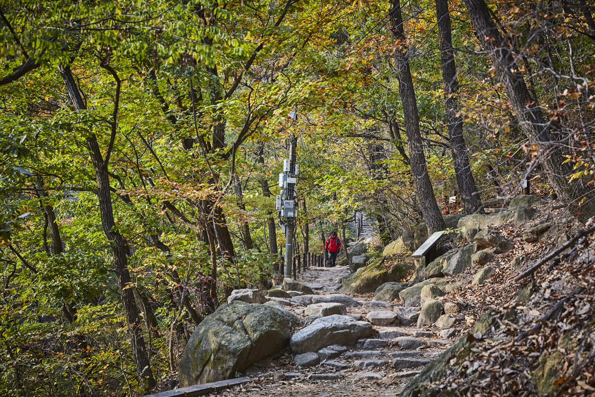
Bukhansan National Park (Ui-dong)북한산 우이동
Gangbuk-gu, Seoul
53 ScoreGranite-peak hiking inside the city limits, with trails ranging from an easy valley walk to a full ridge climb.
- Estimated travel time
- Approx. 50 min by public transit Full route ↓
- Walking difficulty
- Moderate 8 min from 북한산우이
- Event
- No event on this date
- Data freshness
- 2026-08-17 Curated estimate
Route verified from Seoul Station, checked 2026-08-26
Get directions in Google Maps Directions from Seoul StationTimes above use Kakao transit data. The first button uses your current location in Google Maps; live routes may differ.
Nature- Well inside your time budget — about 50 min each way
Full route (50 min, 1 transfer, ₩1,750)
- Start at Seoul Station
- Take Subway 4호선 from 서울역 to 성신여대입구(돈암) (16 min)
- Walk to the next connection (4 min)
- Take Subway 우이신설 from 성신여대입구 to 북한산우이 (20 min)
- Walk from the last stop to the destination (8 min)
Checked against Kakao Maps's public-transit search on 2026-08-26. Service frequency isn't reported by this data, so a route shown here could still run infrequently — this reflects that a path exists, not how often it runs.
How this score was calculated
Interest match 26.0 / 40 Travel fit 15.3 / 25 Walking fit 11.4 / 15 Event bonus 0.0 / 15 Season fit 0.0 / 5 Total 53 / 100 -

Sorae Ecology Park소래습지생태공원
Namdong-gu, Incheon
45 ScoreFormer salt flats turned coastal wetland reserve, with restored salt-evaporation ponds and a windmill.
- Estimated travel time
- Approx. 1 hr 24 min by public transit Full route ↓
- Walking difficulty
- Moderate 11 min from 소래포구입구.논현푸르지오A
- Event
- No event on this date
- Data freshness
- 2026-08-17 Curated estimate
Route verified from Seoul Station, checked 2026-08-26
Get directions in Google Maps Directions from Seoul StationTimes above use Kakao transit data. The first button uses your current location in Google Maps; live routes may differ.
NatureSeaFull route (84 min, 1 transfer, ₩3,700)
- Start at Seoul Station
- Take Subway 4호선 from 서울역 to 선바위 (22 min)
- Walk to the next connection (5 min)
- Take Bus M6410 from 선바위역2번출구(광역) to 소래포구입구.논현푸르지오A (45 min)
- Walk from the last stop to the destination (11 min)
Checked against Kakao Maps's public-transit search on 2026-08-26. Service frequency isn't reported by this data, so a route shown here could still run infrequently — this reflects that a path exists, not how often it runs.
How this score was calculated
Interest match 26.0 / 40 Travel fit 8.7 / 25 Walking fit 10.0 / 15 Event bonus 0.0 / 15 Season fit 0.0 / 5 Total 45 / 100 -
Namhansanseong Fortress남한산성
Gwangju, Gyeonggi-do
48 ScoreA UNESCO-listed mountain fortress with a walkable wall circuit, temples inside the walls, and a view back over Seoul.
- Estimated travel time
- Approx. 1 hr 19 min by public transit Full route ↓
- Walking difficulty
- Easy 7 min from 남한산성도립공원
- Event
- No event on this date
- Data freshness
- 2026-08-17 Curated estimate
Route verified from Seoul Station, checked 2026-08-26
Get directions in Google Maps Directions from Seoul StationTimes above use Kakao transit data. The first button uses your current location in Google Maps; live routes may differ.
NatureTempleNight View- Almost no walking — 7 min from Namhansanseong bus terminus
Full route (79 min, 3 transfers, ₩2,050)
- Start at Seoul Station
- Take Subway 4호선 from 서울역 to 동대문역사문화공원(DDP) (8 min)
- Walk to the next connection (3 min)
- Take Subway 2호선 from 동대문역사문화공원(DDP) to 잠실(송파구청) (22 min)
- Walk to the next connection (4 min)
- Take Subway 8호선 from 잠실(송파구청) to 산성 (16 min)
- Walk to the next connection (5 min)
- Take Bus 9-1(휴일) from 산성역.포레스티아동문 to 남한산성도립공원 (15 min)
- Walk from the last stop to the destination (7 min)
Checked against Kakao Maps's public-transit search on 2026-08-26. Service frequency isn't reported by this data, so a route shown here could still run infrequently — this reflects that a path exists, not how often it runs.
How this score was calculated
Interest match 26.0 / 40 Travel fit 9.6 / 25 Walking fit 11.9 / 15 Event bonus 0.0 / 15 Season fit 0.0 / 5 Total 48 / 100 -
Paju Provence Village파주 프로방스
Paju, Gyeonggi-do
46 ScoreA pastel-painted shopping and dining village, at its most photogenic during the winter light display.
- Estimated travel time
- Approx. 1 hr 4 min by public transit Full route ↓
- Walking difficulty
- Demanding 16 min from 오도삼거리
- Event
- No event on this date
- Data freshness
- 2026-08-17 Curated estimate
Route verified from Seoul Station, checked 2026-08-26
Get directions in Google Maps Directions from Seoul StationTimes above use Kakao transit data. The first button uses your current location in Google Maps; live routes may differ.
CafeNight ViewFull route (64 min, 2 transfers, ₩4,650)
- Start at Seoul Station
- Take Subway GTX-A from 서울역 to 운정중앙 (22 min)
- Walk to the next connection (2 min)
- Take Bus 67 from 운정중앙역(지하) to 다율동 (12 min)
- Walk to the next connection (1 min)
- Take Bus 77-1 from 다율동 to 오도삼거리 (7 min)
- Walk from the last stop to the destination (16 min)
Checked against Kakao Maps's public-transit search on 2026-08-26. Service frequency isn't reported by this data, so a route shown here could still run infrequently — this reflects that a path exists, not how often it runs.
How this score was calculated
Interest match 26.0 / 40 Travel fit 12.6 / 25 Walking fit 7.8 / 15 Event bonus 0.0 / 15 Season fit 0.0 / 5 Total 46 / 100 -
Yangju Nari Park양주 나리공원
Yangju, Gyeonggi-do
44 ScoreA large public flower park that stages a well-known cockscomb and cosmos display in early autumn.
- Estimated travel time
- Approx. 1 hr 21 min by public transit Full route ↓
- Walking difficulty
- Moderate 14 min from 덕정주공4단지
- Event
- No event on this date
- Data freshness
- 2026-08-17 Curated estimate
Route verified from Seoul Station, checked 2026-08-26
Get directions in Google Maps Directions from Seoul StationTimes above use Kakao transit data. The first button uses your current location in Google Maps; live routes may differ.
NatureFestivalFull route (81 min, 2 transfers, ₩3,650)
- Start at Seoul Station
- Take Subway 4호선 from 서울역 to 창동 (30 min)
- Walk to the next connection (2 min)
- Take Subway 1호선 from 창동 to 덕정(서정대학) (26 min)
- Walk to the next connection (4 min)
- Take Bus 8906 from 덕정역 to 덕정주공4단지 (5 min)
- Walk from the last stop to the destination (14 min)
Checked against Kakao Maps's public-transit search on 2026-08-26. Service frequency isn't reported by this data, so a route shown here could still run infrequently — this reflects that a path exists, not how often it runs.
How this score was calculated
Interest match 26.0 / 40 Travel fit 9.3 / 25 Walking fit 8.7 / 15 Event bonus 0.0 / 15 Season fit 0.0 / 5 Total 44 / 100 -

Dumulmeori두물머리
Yangpyeong, Gyeonggi-do
42 ScoreThe confluence of the north and south branches of the Han River, known for its old zelkova tree and morning mist.
- Estimated travel time
- Approx. 1 hr 28 min by public transit Full route ↓
- Walking difficulty
- Moderate 15 min from 양수리두물머리
- Event
- No event on this date
- Data freshness
- 2026-08-17 Curated estimate
Route verified from Seoul Station, checked 2026-08-26
Get directions in Google Maps Directions from Seoul StationTimes above use Kakao transit data. The first button uses your current location in Google Maps; live routes may differ.
NatureCafeFull route (88 min, 2 transfers, ₩2,250)
- Start at Seoul Station
- Take Subway 4호선 from 서울역 to 이촌(국립중앙박물관) (8 min)
- Walk to the next connection (3 min)
- Take Subway 경의중앙선 from 이촌 to 양수 (54 min)
- Walk to the next connection (2 min)
- Take Bus 8-44 from 양수역 to 양수리두물머리 (5 min)
- Walk from the last stop to the destination (15 min)
Checked against Kakao Maps's public-transit search on 2026-08-26. Service frequency isn't reported by this data, so a route shown here could still run infrequently — this reflects that a path exists, not how often it runs.
How this score was calculated
Interest match 26.0 / 40 Travel fit 7.9 / 25 Walking fit 8.3 / 15 Event bonus 0.0 / 15 Season fit 0.0 / 5 Total 42 / 100